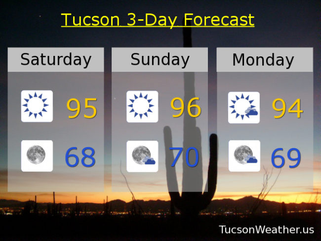
Forecast for Saturday, September 22, 2018

Meteorologically speaking, Fall consists of the months of September, October and November. Astronomically speaking, Fall starts atĀ 6:45 tonight when our nearest star, the Sun, will be directly over the Equator. On it’s journey back over the southern Hemisphere bringing them Spring, butterflies, baby bunnies, meadows full of flowers, and allergies. Meanwhile, here in the northern Hemisphere we will brace for frozen tundra, (Reeses Peanut Butter Cup) Blizzards, snow dayz and dreary overcast skies. That is, unless you live in Tucson! We will brace for not having to run air conditioning (as much), being able to go hiking in the middle of the day! (shocking, I know) enjoying the top down on our convertibles, and welcoming our friends back from Michigan. Good times are Shirley ahead!

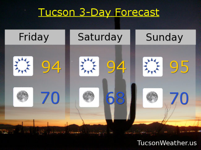
Sunny skies in the forecast through the entirety of next week. An east breeze today thanx to strong high pressure in the Plains. Call it sunny today with an east wind 10-20 mph and gusty and a high in the mid 90s. Clear skies tonight upper 60s. Mid 90s for highs through Friday. Lows in the upper 60s to near 70. Enjoy!
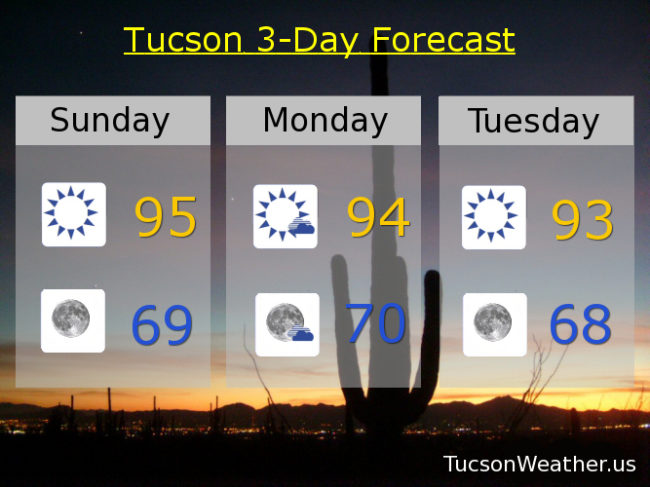
Forecast for Friday, September 21, 2018

It’s Friiidaaay!!!

Not a lot going on weather-wise. I guess the biggest story will be the east winds tomorrow. High pressure moving in behind a cold frontĀ  in the Plains will give us a strong easterly flow at the surface and that translates to east breezes tomorrow gusting over 20 mph. Breezy on Sunday too. Highs today through Thursday in the mid 90s. Lows glorious lows through Thursday in the upper 60s to near 70. Enjoy!

Forecast for Thursday, September 20, 2018

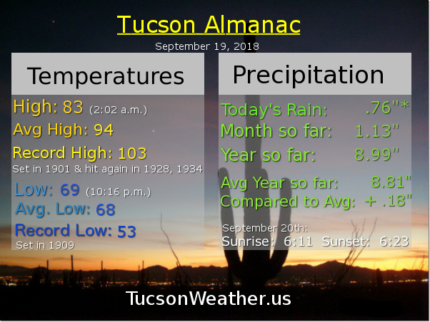
Wow! What a day yesterday!!! Record rainfall at the airport. .76″. If that’s it for Monsoon 2018 (and it probably is) what a way to say goodbye! A steady rain for HOURS yesterday afternoon and last night. Most picking up .75″ to over an inch of rain, and yes, there were some who picked up over 2 inches! Good job. The Flash Flood Watch jinx is no more.

A trough moving through the state will scrub us clean of any moisture. Perhaps enough lingering for a slight chance of a storm today, but I doubt it. We’ll warm back up again, but those lows. Back to feeling a little like Fall on the patio/deck for morning coffee.

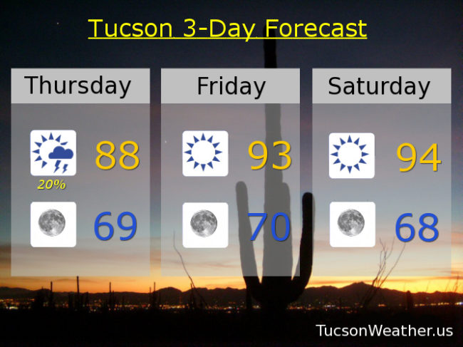
Slight chance of a storm today upper 80s to near 90. Sunny tomorrow low 90s. Mid 90s Saturday through Wednesday. Lows in the upper 60s to near 70! Enjoy!

Forecast for Wednesday, September 19, 2018

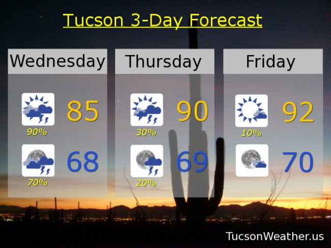
A record amount of moisture for a September 19th in place. Add some energy as a trough approacheth from the west and you have a recipe for numerous showers and storms with locally heavy rainfall. So. The National Weather Service has issued a FLASH FLOOD WATCH starting at 11:00 this morning in effect until 11:00 tonight. The forecast calls for .75″ – 2.50″ of rain! Hopefully that comes true (hopefully near you) and Monsoon 2018 will leave us with lasting memories. With the clouds and expected rain today’s forecast high is only 85. Showers and storms may last into the overnight hours with a low tonight in the upper 60s. Viva Monsoon 2018!

We get back to a westerly flow starting tomorrow and we start a drying trend. Scattered storms still hanging in there for tomorrow with a high near 90ish. Just a 10% chance Friday low 90s. Sunny mid 90s Saturday through Tuesday.