
Almanac for Monday, February 25, 2019


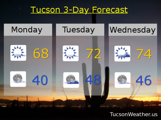
Happy Monday! It could happen. Especially if you like the Sun. The warming trend continues this week as storms will be missing us to the north. One close enough to increase our clouds Tuesday night and Wednesday, otherwise it’s mostly sunny skies with possible sunrise and sunset enhancement. Enjoy!
Mostly sunny today with a high in the upper 60s. Mostly clear tonight near 40ish. Sunny tomorrow low 70s. Partly sunny Wednesday mid 70s. Sunny Thursday and Friday mid 70s. Mostly sunny Saturday mid 70s. Low 70s Sunday.
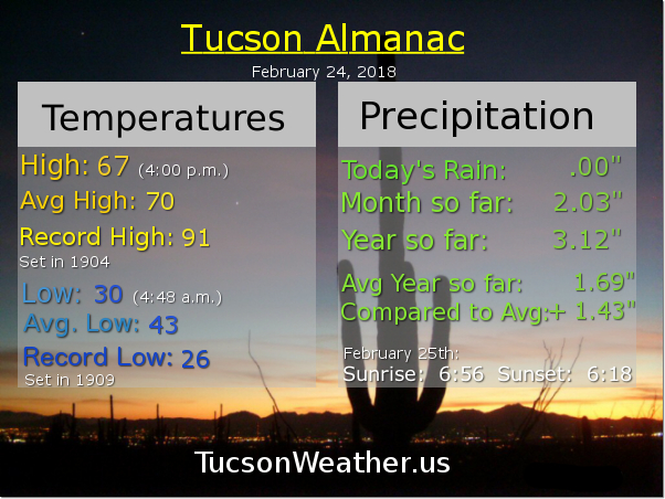
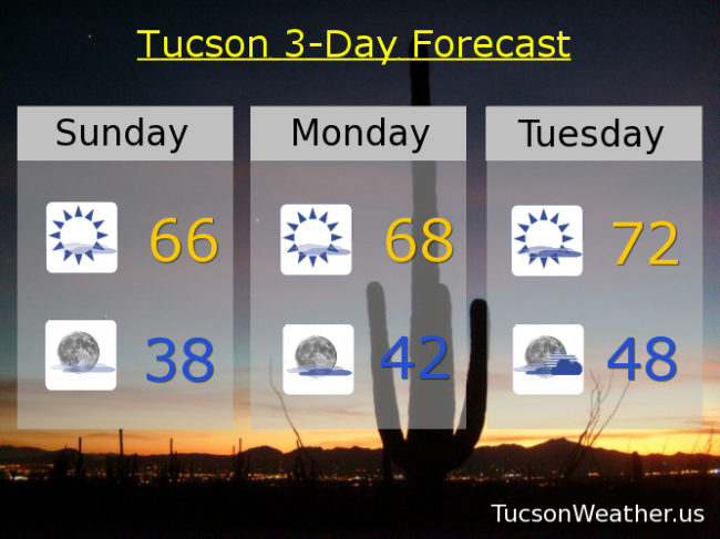
The plants got to hang out inside one more night and once the Sun starts to warm things up this morning it’s back on the deck. Let the warming trend begin! I guess the big question is will the road to Mt. Lemmon open up today? If so, look for a crush of humanity to head up the hill to play in the snow! A few high clouds from time to time this week for possible sunrise and sunset enhancement. Mostly cloudy Tuesday night and partly sunny Wednesday as a system misses us to the north, but no threat of rain or snow around these parts. Temperatures actually slightly above average (70) by Tuesday into Saturday. Enjoy!
Mostly sunny today with a high in the mid 60s. Mostly clear tonight upper 30s. Upper tomorrow. Low 70s Tuesday. Partly sunny Wednesday mid 70s. Sunny Thursday mid 70s. Mostly sunny Saturday low 70s.

Here we are. 7:30 in the morning with frost covering everything and all of the mountains covered in snow. Maybe you live in Corona de Tucson or Catalina and you still have snow on the ground and probably icy streets. What a remarkable day we had yesterday! Record rainfall at the airport at 1.03″ and record snowfall at 1.9″! Crazy amazing = Cramazing! (I just made up a word) Summerhaven picked up a couple of feet of snow. I wonder when they’ll open Catalina Highway and I also wonder how long the wait will be to get up there when they do.
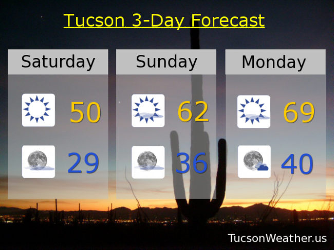
No more storms in the forecast. Just a warming trend. Enjoy!
Sunny today near 50ish. Clear and cold tonight upper 20s. Mostly sunny tomorrow low 60s. Upper 60s Monday. Low 70s Tuesday and Wednesday. Mid 70s Thursday and Friday.

Also, 1.9″ of snow was recorded which is a record for the date.

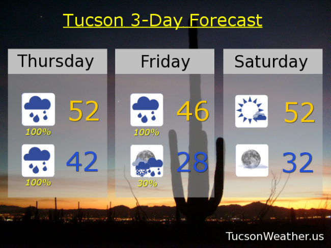
Are you ready? The storm is moving in. Phrases like “blizzard like conditions” and “rain could be heavy at times” are being thrown around. For good reason! Because there could be blizzard like conditions (should that be hyphenated?) in the mountains and the rain could be heavy at times from this storm! If you have hatches you might want to batten them down. I grew up in Oregon so I don’t have an umbrella, but if you didn’t grow up in Oregon perhaps a handy umbrella would be, um, handy. Rain, heavy at times, by this afternoon lasting through Friday. Still not sure if we will see snow in the Metro by Saturday morning. It will be close. Still expecting 3 to 4 feet of snow in Summerhaven. Three-quarters to an inch and a half of rain for valley locations with isolated amounts up to two inches.
The storm moves out Saturday and we’ll start to warm up. Pretty much average for this time of year by Tuesday and Wednesday. Stay tuned!
Showers and breezy today with a high in the low 50s. Showers tonight with heavy rain possible and a low in the low 40s. Showers tomorrow with heavy rain possible and a high in the mid 40s. A chance for rain and snow showers late Friday night becoming mostly clear and a low in the upper 20s. Sunny Saturday low 50s. Low 60s Sunday. Mid 60s Monday. Upper 60s Tuesday. Near 70ish Wednesday. Enjoy!
