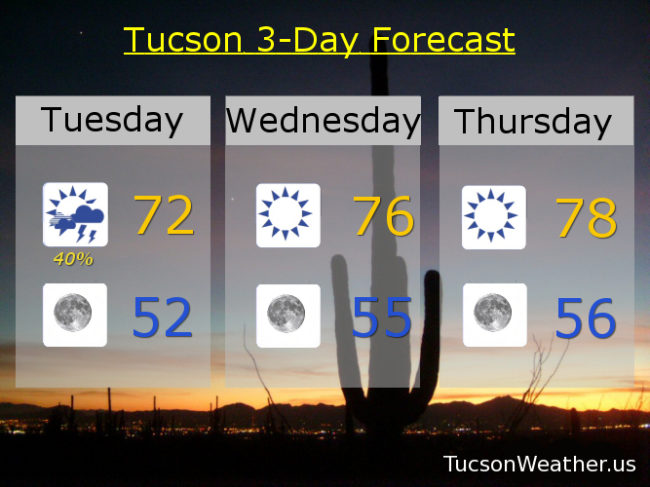
That was fun! A few rumbles of thunder overnight along with some downpours to interrupt our pleasant dreams. The airport picked up .11″ last night before midnight and another .30″ since. Two weeks into October and we have over 2.00 inches for the month! A FLOOD ADVISORY is till in effect until 7:00 this morning. Be advised. There could be flooding. Most of the showers have moved off to the east, but it’s still raining as I type over the Rincons, portions of the Catalina’s, and in Vail. We could still see redevelopment of showers and storms today as our low moves into central Arizona. We’ll call it a 40% chance with a high in the low 70s. We should be cleared out for the most part by this evening with a low in the low 50s.
Our next storm (yes, two more actually) aren’t due in until the weekend. So. A bit of a warming trend the rest of the work week, but still below average for mid October. Crazy! I know.
Sunny tomorrow mid 70s with east breezes 10-20 mph and gusty. Sunny Thursday upper 70s. Low 80s Friday. Our next storm approacheth Saturday with a 20% chance for showers, breezy, and a high in the mid 80s. 30% Sunday low 80s. 10% Monday low 80s. Enjoy!