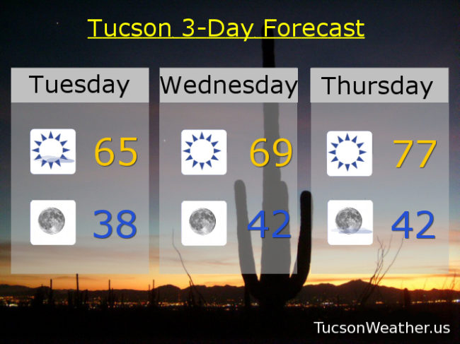
Our exiting storm system is exiting to the east leaving us with mostly clear skies in it’s wake. A bit of coolness in the air as well with lows tomorrow morning back in the 30s! Then high pressure building back in and we will warm up rather quickly, especially Thursday, with highs in the upper 70s by the end of the week. Everyone into the pool! (Wait. Not everyone is a member of the Polar Bear Club) Record highs for Thursday and Friday are both 80. We’ll be getting close if the forecast comes exactly true (hey, it could happen). Then it’s a series of systems that will cool us off just in time for Christmas. It should stay dry, but it looks like one around Friday. Another late Saturday into Sunday. Then another Monday. Perhaps (possibly. it’s a long ways out still) a stronger storm with rain and mountain snow late Christmas into Thursday of next week. Stay tuned!
Sunny today and cooler with a high in the mid 60s. Chilly tonight (mmm chili) with a low in the upper 30s. Sunny tomorrow upper 60s. Upper 70s Thursday. Mostly sunny Friday upper 70s. Mid 70s Saturday. Sunny low 70s Sunday. Upper 60s Monday.