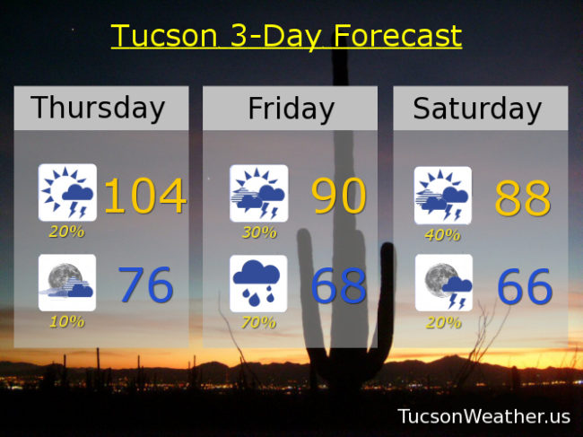
Let’s get this party started! Monsoon 2018 officially starts tomorrow, but we may see a bit of action today. Dewpoints in the 30s this morning combined with off and on clouds overnight has given us a rather warm start to the day. 80 has been the low so far and that will probably be it. The better news is that moisture will increase throughout the day thanx to our southerly flow which may lead to a few storms this afternoon/evening in the Metro, hopefully near you! Storms that form may generate gusty winds and even blowing dust, so there’s that. Not as hot as yesterday’s 106, but still kinda hot with a high near 104.
Mostly cloudy tonight with a slight chance for a lingering storm and a low in the mid 70s.
Here’s comes the moisture from the remnants of Hurricane Bud tomorrow! Moisture levels near records for mid June by afternoon/evening. Scattered afternoon and evening storms with a high near 90. As the deeper moisture moves in tomorrow night we will shift to more of just plain rain showers with maybe a storm. Some of the showers tomorrow and tomorrow night may be on the heavy side. Since Bud’s main track is now expected to veer into SW New Mexico the best chance for heavy rain will be Santa Cruz and Cochise county, but Tucson still may get in on some heavy showers. Just be aware that areas of flash flooding may still be possible. Tucson is expecting a half inch to an inch of much needed rain. Certainly some locally higher amounts may occur.
Rain is likely Friday night into Saturday morning. Again, locally heavy rain is possible. Moisture hangs on through Saturday with mostly cloudy skies and a chance for afternoon and evening storms with a high in the upper 80s.
A trough to our north will push the moisture outta here on Sunday with sunshine and a high in the mid 90s. Upper 90s Monday and Tuesday. Near 100 Wednesday. Viva Monsoon 2018!