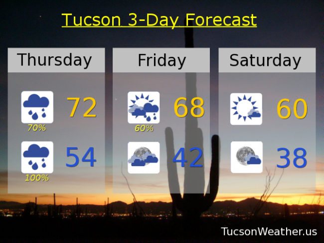
“Let your love flow… like a mountain stream… and let your love show and you’ll know what I mean…” Um. Those mountain streams will be flowin’ tonight! And I’m not (just) being metaphorical. There is an actual FLOOD WATCH for mountain streams from tonight at 6:00 until tomorrow morning at 11:00. Heavy rain in the mountains, especially west and southwest facing slopes, could lead to heavy runoff. Pay especially close attention to Sabino Creek, Tanque Verde Creek, Rincon Creek and the Canada del Oro Wash. So what in the world is going on?! A river of tropical moisture is moving through through tomorrow. As the moisture gets lifted by the mountains they could see 2 to 3 inches of rain with higher amounts in some areas. Crazy! Meanwhile, a nice soaking expected in valley locations with a half inch to three-quarters for most of us. Prime time is tonight, but we may see a few showers by this afternoon.
The weekend looks sunny but cool. Then a colder system drops in with rain and mountain snow chances Sunday night through Monday night. Snow levels Monday night could crash down to the valley floors perhaps. Lots of time to sort that out. Either way, colder temperatures are returning to us. Stay tuned!
Cloudy today with showers likely by this afternoon and evening and a high in the low 70s. Showers and breezy tonight with WSW winds gusting to near 30 mph and a low in the mid 50s. Showers likely tomorrow morning and then tapering off with mostly cloudy skies and a high in the upper 60s. Mostly sunny Saturday and Sunday with highs in the upper 50s to near 60ish. A 30% chance for showers Sunday night and 40% for Washington’s Birthday (Happy Birthday George!) and a high in the low 50s. 30% Monday night and then clearing with a low near freezing. Mostly sunny Tuesday 55ish. Upper 50s Wednesday.