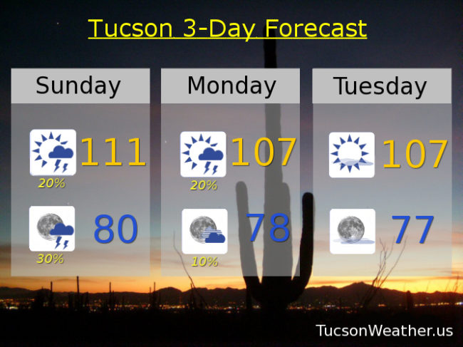
Outflow winds from storms to our east have brought us clouds and moisture to start the day. As a result we are off to a warmer than the last few days start to the day. Thanx to the moisture increase we are looking at isolated to scattered storms this afternoon and evening! Expect gusty winds near storms but a few folks will also get a nice shower, hopefully near you. Today is also our last day of the EXCESSIVE HEAT WARNING that has been in effect all week. Tedious and buh bye. Moisture lingers into tomorrow and then our epic high pressure retreats south as a couple of systems move through the Great Basin. That will put us in a dry westerly flow drying us out some most of this week and also “cooling” us to near normal highs for this time of year. Tropical Storm Dora will move to near the tip of the Baja Peninsula. That moisture will move into Mexico priming the pump for the start of Monsoon 2017 for reals! Stay tuned!
Partly cloudy today with a chance for afternoon storms and a high near 111.
Partly cloudy tonight with scattered storms before midnight and a low near 80.
Mostly sunny tomorrow with isolated afternoon storms and a high near 107. Sunny near 107 Tuesday. 104 Wednesday. 103 Thursday. 105 Friday. Chance for storms Saturday 106.