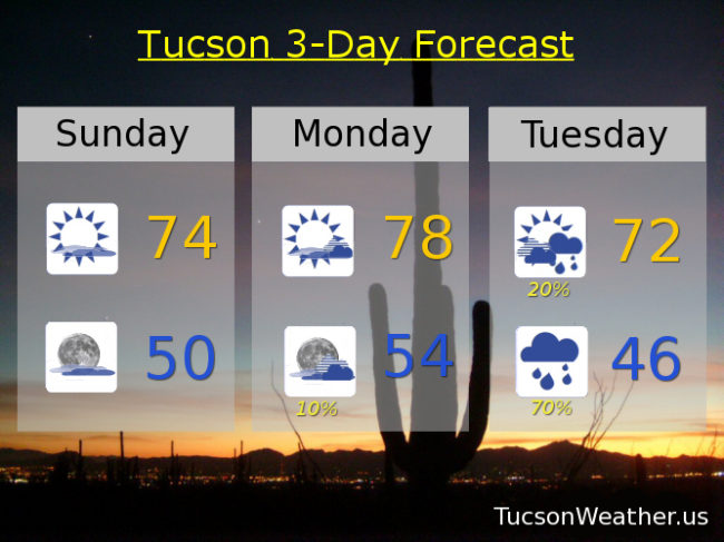
High clouds overnight associated with a system moving through the Four Corners has kept some of the heat from escaping into space (echo: space, space, space… ). A mild start to another warm southern Arizona day with decreasing clouds today. Clouds will be on the increase tonight as our next storm approacheth. The forecast is still looking promising for valley rain and mountain snow! By tomorrow the system will be moving into southern California with a slight chance for light rain as early as tomorrow night. The main event will be Tuesday night as the storm moves through with showers lingering into the first half of Wednesday. Snow levels will start quite high; above 8,000 feet, but will crash perhaps as low as 5,000. Could see 4-8 inches above 7,000 feet so some sledding in the Catalinas might be in order. Valley locations still expecting up to a half inch of rain, perhaps a bit more. The storm keeps truckin’ so clearing skies Wednesday afternoon and a warming trend for the end of next week. Enjoy!
Decreasing clouds today with a high in the mid 70s.
Increasing clouds tonight with a low near 50ish.
Partly sunny tomorrow with a high in the upper 70s.
Isolated showers Tuesday with showers likely Tuesday night. High in the low 70s. Low in the mid 40s.
Scattered showers Wednesday morning becoming mostly sunny and a high near 60.
Sunny Thursday mid 60s. Mid 70s Friday and Saturday.