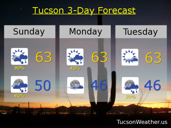
Yesterday’s sprinkles and rain chances overnight were greatly exaggerated! However. The cold front is still on it’s way. It’s just fashionably late. Hopefully it will bring the seven layer dip for the big game! (mostly cloudy with a chance for guacamole?!) Well, it is bringing rain showers as advertised. In fact it was light raining on the deck just a bit ago. (hashtag #notfakenews) The slow movement of the weakening storm means showers lingering into tomorrow. Super Sunday won’t be a super soaker, but still expecting a tenth to four tenths of an inch of rain in the Metro. An inch of rain possible in the mountains with the snow level way up there above 8,500 feet! Snow mixing in with the rain today in Summerhaven with snow showers through Wednesday night, but no real accumulations expected until Wednesday and Wednesday night. A break in the action Monday night and Tuesday between systems. Our next storm due in here Tuesday night through Wednesday looks colder, but not as much moisture. Rain showers in the valleys and lower mountain snow. Colder to end the week behind our next storm with lows back down to freezing in Tucson Friday morning. Then some warming next weekend. Stay tuned!
Showers today with a high in the low 60s. Scattered showers tonight low near 50ish. Scattered showers tomorrow low 60s. Partly sunny Tuesday low 60s. 30% Tuesday night mid 40s. 40% Wednesday low 50s. 20% Wednesday night becoming partly cloudy low 30s. Sunny Thursday low 50s. Freezing Friday morning and sunny during the day low 60s. Sunny Saturday mid 60s. Enjoy!