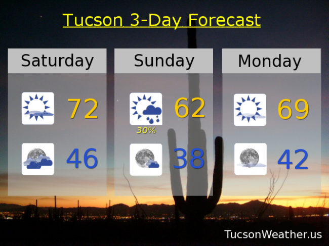
Top o’ the afternoon to ya! Sorry for the late update, but I wanted to make sure I didn’t skip today because we have a bit o’ excitement headed our way tonight/tomorrow. A storm approacheth and the wind has been picking up a bit this afternoon. Clouds will be on the increase tonight with a cold front blowing through sometime around 3am – 5am. Most of our expected rainfall should occur ahead of and near the front. Not a lot of moisture to work with and the main system will be to our north, so likely less than a tenth of an inch for most valley locations. An inch or three of snow possible above 5,500 – 6.000 feet, so a little bit. Rain ends tomorrow morning with clearing skies by afternoon and much cooler with a high only near 62. Gusty SSW winds overnight relaxing some during the day tomorrow.
Mostly sunny Monday with a high near 69. Upper 70s Tuesday.
Another storm missing us to the north will give us more clouds Wednesday and a slight chance of rain Thursday. Low 80s both days. Slight chance for a lingering shower Friday mid 70s. Sunny Saturday mid 70s. Enjoy!