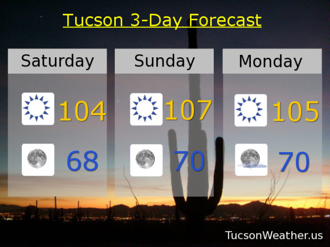
Hot and getting hotter! Must be June. Yesterday we just missed the century mark with a high of 99. With high pressure building in it will be noticeably hotter the next few days. Today’s expected high of 104 is well short of the record of 108, so that will stay safe. However, tomorrow’s expected high of 107 is right at the record set in 1996 and hit again in 2014 and 2016, so there’s that. Please stay hydrated lest you burst into flames! A weak low moving from Baja California into the NW part of the state will give us some breezes through the weekend too, so kinda like a hot blow dryer. “Things” get a bit interesting mid to late next week as the high pressure moves north and east. That will put us in a southerly flow with an increase of mid and high level moisture. However, the low level moisture won’t quite make it out of Mexico. Expect a chance for a few storms over the mountains east of Tucson with fire causing lightning a real threat. Heating up again by the end of next week. June has arrived! Be cool and stay safe.
Sunny and kinda hot today with a high near 104 and a SW breeze 5-15 mph and gusty.
Clear tonight with wonderful coffee on the deck temperatures tomorrow morning in the upper 60s.
Sunny and a bit breezy tomorrow with a record tying high of 107 if it comes exactly true.
105ish Monday. 103 Tuesday. 104 Wednesday. 106 Thursday. 108 Friday.