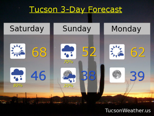
Increasing clouds today as our next storm approacheth. This system will be tapping in to record amounts of moisture for early January and it will start as a warm system. That means rain, heavy at times, tonight in the mountains. Combine that with melting snow and we should end up with running washes and rivers that are fed from Mountain runoff. I’m looking at you Canada del Oro Wash and Rillioto River and their tributaries. Maybe even flooding concerns as we combine the runoff with up to an inch of rain in the lowlands through tomorrow. Please. Enjoy Winter 2019 responsibly. Rain turns into snow tomorrow in the mountains above 7,500 feet as Summerhaven begins working on a new snow pack. 3 to 7 inches expected there tomorrow.
The storm moves out by Monday and we warm up some Tuesday and Wednesday. A slight chance for showers Wednesday night and Thursday. Then another strong storm possible for next weekend! But we’ll burn that bridge when we get to it. Stay tuned!
Increasing clouds today with a high near 68ish. 80% chance for showers tonight with a low in the mid 40s. 70% chance for showers tomorrow with a high in the low 50s. 20% chance for showers Sunday night upper 30s. Mostly sunny Monday low 60s. Upper 60s Tuesday and Wednesday. 20% Thursday mid 60s. Sunny Friday mid 60s. Enjoy!