
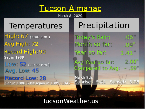
Almanac for Tuesday, March 10, 2020


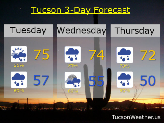
Just wow! Is this really reality or are we in a simulation? Perhaps our future selves are interested in seeing what would happen if the Sonoran Desert received rain for almost an entire week in March? Perhaps. Or. This is reality and we have to deal! It won’t be a steady rain for the whole week, but rather periods of rain through Friday. A storm system currently off the coast of California will slowly be moving our way. Lots of tropical moisture streaming northward ahead of the low with disturbances in the force triggering areas of rain. The storm itself should move through by Friday. Total rainfall amounts could be a half inch to two and a half inches in valley locations! The mountains should get even more with snow levels higher than the highest peaks until the very end. Get ready to fill those cisterns! And yeah, sometimes the skies ARE cloudy all day. Details in 3… 2…
Mostly cloudy today with scattered showers and a high in the mid 70s. Showers likely tonight upper 50s. Showers likely tomorrow with perhaps a few thunderstorms mid 70s. Showers and storms likely Thursday low 70s. Showers likely Friday mid 60s.
Clearing out Friday night just in time for a sunny weekend. Near 70ish Saturday. Mid 70s Sunday. Mostly sunny Monday low 70s. Don’t look now, but another round of showers possible by Tuesday of next week. Stay tuned and enjoy!

Happy Monday! It could happen.
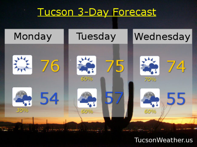
A big storm hangin’ ten off the California Coast will be sending us moisture and disturbances in the force for an extended period of unsettled Tucson Weather (see how I got the branding in there?) 🙂 Just looking at the official forecast from the National Weather Service we have Showers Likely for Tuesday, Tuesday Night, Wednesday, Wednesday Night, Thursday, and Thursday night! Throw in a few thunderstorms and a continued chance for showers Friday and you’ve got (you have got?) a recipe for a half inch to over two inches of rain for the Metro this week! We’ll see how it all plays out. Stay tuned!
Sunny today with increasing clouds this afternoon and a high in the mid 70s. A chance for showers tonight mid 50s. Showers likely tomorrow morning otherwise mostly cloudy mid 70s. Showers likely Wednesday with thunderstorms possible after noon mid 70s. Showers likely and possibly a thunderstorm Thursday near 70ish. Partly sunny Friday with a 50% chance for showers upper 60s. Sunny Saturday low 70s. Upper 70s Sunday. Enjoy!
As the rest of the country shows up to church an hour late because they forgot to Spring Forward, Arizonans enjoyed another night of regularly scheduled sleep last night. Funny thing that Daylight Savings Time. It artificially creates a nation of cranky people with higher heart attack and accident rates as they adjust. Arizonans remain well adjusted year ’round. So I raise my coffee mug to the Grand Canyon State from sleep deprived Texas. Here’s to you! May the rest of the country follow your lead and adopt your wisdom. Let’s keep Standard Time as the standard! Arizonans are tired of their national cable shows being on an hour earlier, and the rest of the country is, well, just tired. Where was I? Oh yeah. The Tucson Weather Fore-guess! 🙂 Here we go…
A few showers around today with plenty of sunshine too. Be on the lookout for rainbows! Unicorns too I suppose, but I’m not sure I would tell anyone if I saw one. (I brake for hallucinations) Cooler today with a high this afternoon of 70ish. A brief break from the showers tomorrow with mostly sunshine and a high in the upper 70s.
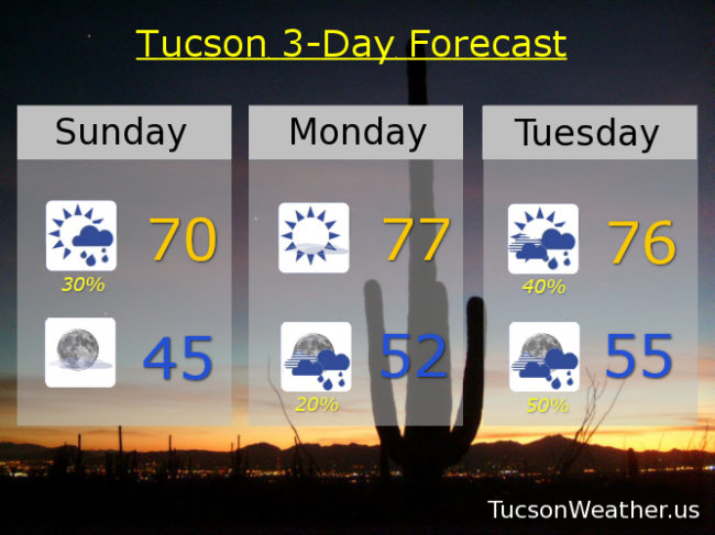
An extended rainy/showery period the rest of the week is in store as a large storm system is off the California coast. It will be drawing moisture northward into the Southwest as it spins to our west. Embedded disturbances in the force will bring shower chances from time to time Tuesday through Friday perhaps lingering into Saturday! A 40% chance Tuesday mid 70s. 60% Wednesday upper 70s. 50% Thursday low 70s. 40% Friday upper 60s (as the main low tracks through). 10% Saturday otherwise mostly sunny low 70s. Enjoy!

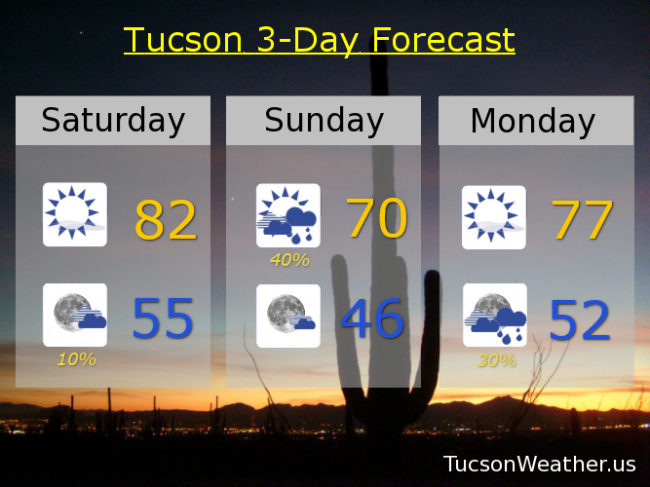
It was the best of weekends. It was the worst of weekends. It is the weekend of our (dis)content. A little something for the Sunshine on My Shoulder folks followed by the Ain’t No Sunshine when it’s gone gang. Low 80s again today (it was 81 yesterday) with sunshine and an easterly breeze 5-15 mph. An increase of moisture will bring us rain chances tomorrow with a high near 70ish.
Timeout on the court with a break in the action on Monday. Highs rebounding to the upper 70s. Moisture returns for the rest of the week and so do the rain chances! Mostly cloudy with a 50% chance for showers Tuesday upper 70s. Showers likely (60%) Wednesday mid 70s. 40% chance for showers Thursday low 70s. 20% Friday low 70s. Enjoyeth!
It’s Friiidaaay!!! Yabba Dabba Dooooooo!
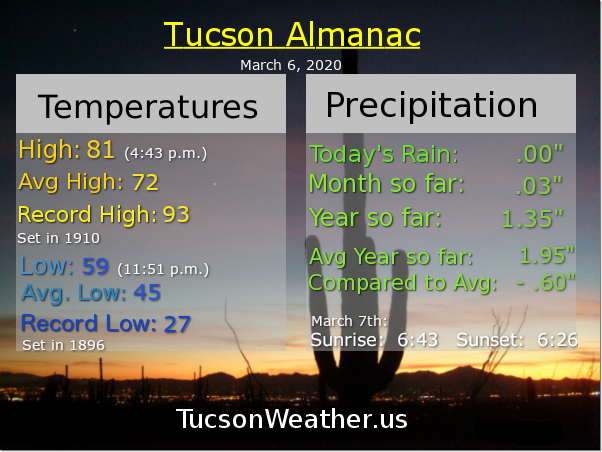
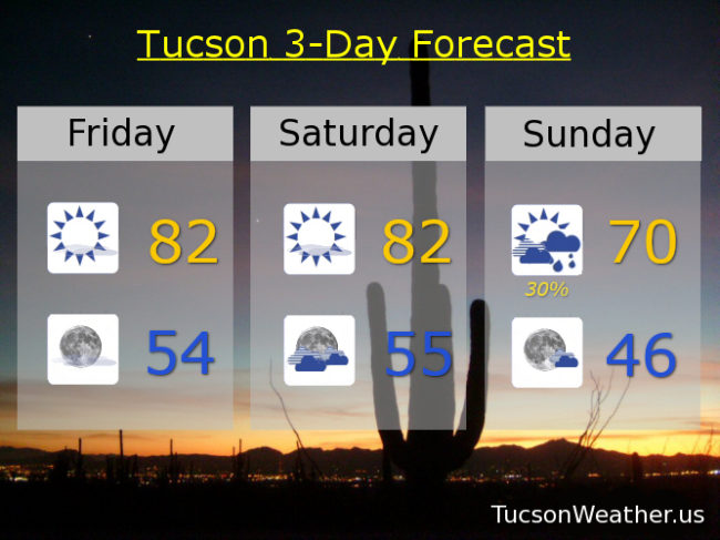
80 was our high yesterday and we’ll do that a couple three degrees better today and tomorrow. (When Will I See You by the Three Degrees?) Get the daggers out you wind haters. Today’s winds ESE 15-25 mph with gusts to 35. Only 5-15 ish tomorrow.
Don’t forget. DON’T turn your clocks forward an hour Saturday night! Meanwhile our next system should bring a few showers Sunday with a high near 70ish. A brief respite Monday between storms with sunshine and a high in the upper 70s. Rain showers should commence again Monday night with rain possible Tuesday, Wednesday, and Thursday! Highs in the upper 70s, mid 70s, and near 70ish respectively. Respectively submitted, Tucson Weather. Enjoy!