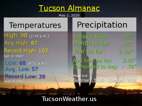
Almanac for Saturday, May 2, 2020


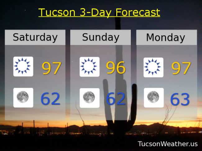
May 1st outperformed itself! 100 yesterday tied the record set in 1943. Yeah. It was hot. Not as hot this weekend with highs in the upper 90s which is still a good 10 degrees above average for early May. Upper 90s continue Monday. Near 100ish Tuesday. 104 Wednesday! 102 Thursday. 99 (I’ve been waiting so long) Friday. Be Cool!

May day May day. It’s Friiidaaay!!!
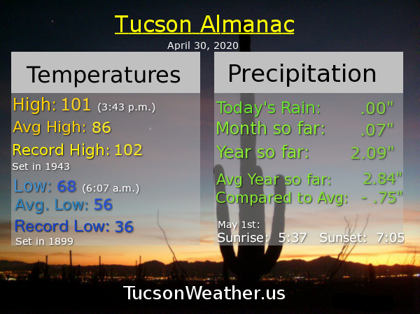
We didn’t even break the record of 102 yesterday much less approacheth the all time April record of 104. 101 didn’t quite live up to the hype, but still respectable for a hot April day.
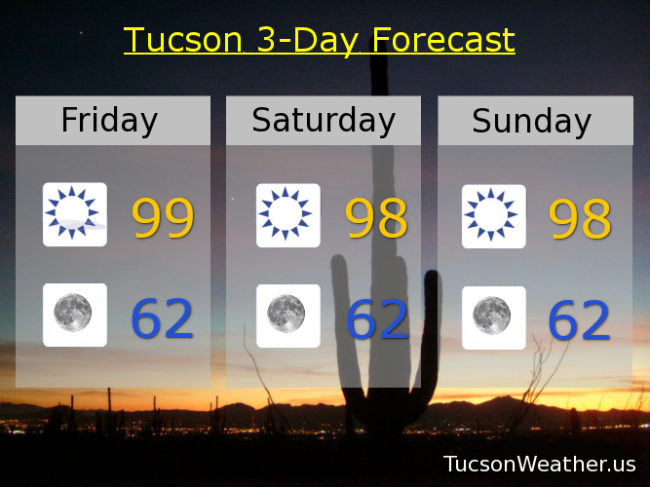
May has arrived and with it a “cool” breeze. 99 (I’ve been waiting so long) this afternoon with SW winds 15-20 gusting to 30. Winds relax tonight with a low in the low 60s. Upper 90s for both dayz of the weekend as well as Monday and Tuesday. Near 100ish Wednesday. 101 Thursday. Enjoy!
Climate Stuff:
Rain in April 2020: .07″
Rain to date in 2020: 2.09″
Rain to date in 2019: 3.81″
Avg rain to date: 2.84″
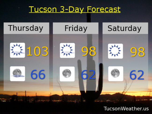
Happy Friday Eve. It makes the weekend seem closer 🙂
We tied the record of 102 yesterday and it was the first 100 degree day of the year. About three weeks earlier than average. No big deal. EXCESSIVE HEAT WARNING for this afternoon with a record breaking high of 103 expected. If we can manage 104 we will tie the all time hottest April day on record. Something to root for!
Then it’s a “cool down” as we start May. Upper 90s tomorrow and breezy fo sheezy with SW winds 15-20 mph gusting to 30. High in the upper 90s. Upper 90s both days this weekend sans the wind. Monday and Tuesday too. Near 101ish Wednesday. Be Cool!

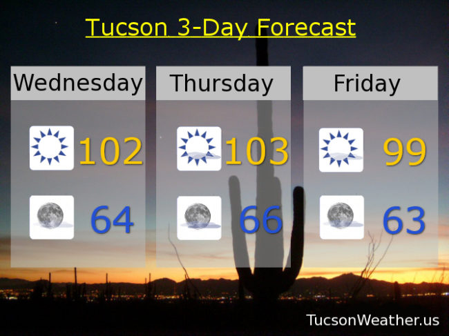
Mike Mike Mike Mike Mike. What day is it Mike? Another record high tying day. That’s what day it is!
The year was 1992. The high was 102. It was the hottest it had ever been on an April 29th. That is. Until 2020. It’s the return of 102. This time it’s personal. (not in theaters anywhere)
Yep. If the forecast comes exactly true we will tie the record high. Today should be the first 100 of the year which will be the 5th earliest first 100 in Tucson’s history. Additionally, tomorrow’s forecast has dropped a degree, but 103 will break the record of 102. That will fall short of the all time high for April of 104 which is still within reach. (I’m not sayin’ I’m just sayin’) An EXCESSIVE HEAT WARNING is still in effect for tomorrow so be warned, the heat will be excessive. Sounds like fun! Stay tuned to Tucson Weather for all the drama.
Sunny today 102. Mid 60s tonight. 103 tomorrow. Breezy and 99 (i’ve been waiting so long) Friday. Mid 90s Saturday. Upper 90s Sunday, Monday, and Tuesday. Enjoy!

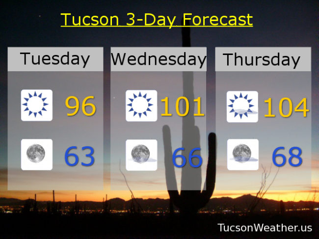
Nice! Only 96 today. Sure, that’s 10 degrees above average for this time of year, but it is 1 degree cooler than yesterday (so there’s that) and much better than the insanity ahead. Low 60s to start the day tomorrow. Tomorrows high near 101 which is 1 short of the record. Thursday will set a new record for April 30th and if 104 comes true then it will tie the hottest day ever recorded in April in Tucson’s recorded history. (I guess no one had pens or thermometers before 1896?) No wonder the National Weather Service has issued an EXCESSIVE HEAT WARNING for Thursday. Be warned. The heat will be excessive. Cooling off to near 100ish on Friday. Upper 90s Saturday. Mid 90s Sunday and Monday. Enjoy!