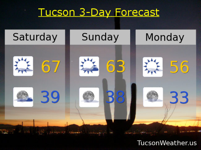
Yesterday was downright balmy compared to the couple dayz before. One more day of the “warm” stuff before another cold front smacks us in the face. (OK, it won’t be quite that dramatic, but kinda) A weakening storm off the California coast is pulling moisture northward into southern Arizona again. Increasing mid and high level clouds today into tonight with a high near the average of 68. Sunrise and sunset enhancement possibilities too. The storm will miss us to the north but drag a cold front through early Monday morning for a “nice” cool down. Maybe some showers as far south as the Metro, but more likely to our north. We warm back up again Tuesday and Wednesday before our next storm. Wednesday night and Thursday could be a rainy time of it with early indications indicating (that’s what indications do, you know) perhaps an inch of rain with this storm. It’s early yet. Predicting the future is hard. We’ll all just have to stay tuned!
Increasing clouds today with a high in the upper 60s. Mostly cloudy tonight upper 30s. Partly sunny tomorrow low 60s. Mostly sunny Monday mid 50s. Mid 60s Tuesday. Partly sunny Wednesday low 70s. 30% chance for rain Wednesday night and 40% Thursday. Thursday’s high in the mid 60s. Partly sunny Friday upper 60s. Enjoy!