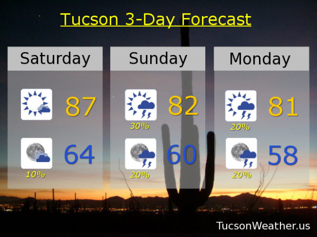
Welcome to the weekend! We haven’t seen this all October, but today will actually be above average! And while it’s true to a large extent that life is what you make it, as far as the high temperature is concerned we will end up 3 degrees above average for October 20th if the forecast comes exactly true. Part of the reason it’ll be so warm is the wind out of the ESE 15-25 mph gusting to near 40! Not considered pleasant by most. As the east winds run downhill the air compresses and warms, so… Also we are starting out relatively warm this morning. Again you can blame that on the wind (or give it credit. Either works). Breezy still tonight with ESE winds 15-25 mph gusting to near 35 with a 10% chance for a storm and a low in the mid 60s.
The main weather player through Tuesday is a low currently located along the California coast. That is kicking up our wind which is also importing more moisture. As disturbances in the force rotate around the low and through the area we should see some showers and storms. The low clears out by Tuesday night.
30% chance for storms tomorrow and still breezy with ESE winds 15-25 mph gusting over 30 and a high in the low 80s. 20% Monday low 80s. 20% Tuesday near 80ish. Sunny Wednesday and Thursday 80. Low 80s Friday. Enjoy!