A severe thunderstorm fell apart right before my eyes over Oro Valley last night. Big time rain last night across the southern part of town including Vail. You probably saw on the news that one person was killed on the south side when his car was swept away in a wash. Please. Enjoy Monsoon 2018 responsibly.
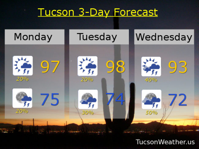
It is amazing on the deck this morning! Lots of sunshine should reload the atmosphere today for pretty much a repeat of yesterday. Storms forming over the White Mountains will make there way our way as the afternoon wears on for a chance of scattered storms this evening. Storms could form earlier mainly south and east of Tucson, but maybe one near you. Once again the Storm Prediction Center is saying we have a marginal threat for severe storms, so we could see a strong to severe storm or two this afternoon/evening. Tomorrow looks a lot like yesterday and today. Highs today and tomorrow in the upper 90s and lows in the mid 70s.
An uptick in activity Wednesday and Thursday as an inverted trough is forecast to move into southern Arizona out of Mexico. That will bring an increase of moisture as well as added lift for numerous storms perhaps lasting through the night Wednesday and Thursday nights! Heavy rainfall will be possible as well. Viva Monsoon 2018! Highs Wednesday and Thursday in the low 90s and lows in the low 70s.
Back to our “average” Monsoon activity Friday through the weekend with storm chances generally 20% to 30%. High Friday in the mid 90s. Upper 90s Saturday and Sunday.