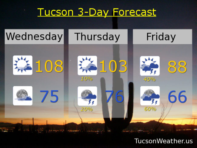
High pressure centered in New Mexico. Close enough for a hot day in Tucson and hot enough for an EXCESSIVE HEAT WARNING. Be warned, there will be excessive heat. Some mid and high clouds around will likely save us from the pain of hitting the record of 110, so there’s that. Also, enough moisture moving in for a slight chance of a storm or two in the mountains.
Call it partly cloudy tonight and warm as moisture from the south continues to increase. That’ll keep the low not so low in the mid 70s.
Deeper moisture moving in tomorrow. A slight chance for storms in the afternoon and a bit better chance for storms in the evening with a high near 103ish. Storms that do form could have gusty winds and blowing dust.
Even deeper moisture moving in on Friday from the remnants of what was once Hurricane Bud. Friday’s forecast is still kind of tricky. Will the clouds move in too early for a cloudy, humid, day with no real trigger for storms to form? Or will there be enough sunshine in the morning to give us a good chance for storms and locally heavy rainfall. Right now the official forecast is for the latter. Let’s hope so. We need it! Either way a high only in the upper 80s!
Good chance for storms continues Saturday with a high in the upper 80s. Drying out Sunday low 90s. Upper 90s Monday. Near 100 Tuesday. Viva Monsoon 2018!