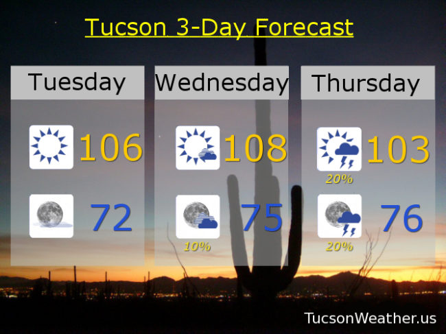
“Things” are getting interesting indeed! High pressure building in today and tomorrow for downright hot weather. I don’t really get too cranky until we hit 110. We are getting annoyingly close with a forecast high tomorrow of 108. Along with that comes an EXCESSIVE HEAT WARNING, so be warned, tomorrow will have excessive heat.
Then the advertised moisture increase starts to arrive with a slight chance for isolated storms perhaps as early as tomorrow evening. Better slight chances Thursday with a high near 103.
Friday looks to be prime time and perhaps into Saturday. Moisture from the remnants of what is now a very strong Hurricane Bud is forecast to surge in here late Thursday into Friday and could lead to isolated severe storms Friday afternoon/evening as well as some locally heavy rainfall! Friday’s high in the low 90s. There is a danger that we’ll get too much moisture and we could end up with cloudy skies and stable conditions with nothing really to get storms going. I don’t think that will be the case Friday, but it’s worth keeping in the back of your mind to avoid the resulting disappointment, depression and emotional overeating should that occur. Assuming it doesn’t, we’ll keep storm chances going Saturday with mostly cloudy skies, some heavy rain possible, and high in the upper 80s!
We dry out Sunday and Monday with highs back in the mid 90s.