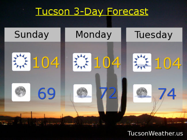
105 yesterday with a few storms about, especially near Sierra Vista. One shower almost (almost) dropped a few drops on the Tucson International Airport! Almost. Drying out today and tomorrow as a system well to our north brings a westerly flow into Arizona. That will keep the deep moisture just to our south in Mexico. It will also keep us on the kinda hot side the next few days.
High pressure re-consolidates to our east by Tuesday and the resulting southerly flow will start to increase our moisture. In addition, Tropical Storm Bud (soon to be Hurricane Bud) will move toward the southern spur of Baja California. That will aid a moisture surge up the Gulf of California into southern Arizona. It looks like all the ingredients are coming together for a kick start of Monsoon 2018 for Tucson by mid to late week! The official start of Monsoon (June 15th) is Friday and it looks like we may have record, or close to record, moisture levels for any June day ever! That could work against us though. If we don’t get enough heating to spark storms we may end up with just a really humid day. Having said that, storm chances start Wednesday, increase Thursday, really ramp up Friday and linger into Saturday. That kind of deep moisture is hard to hold onto this early in the season, so expect some drying by next week. Viva Monsoon 2018! Let’s do this!
Sunny today and tomorrow with a high near 104ish. Low tomorrow morning in the upper 60s.
Mostly sunny Tuesday 104. 10% chance for isolated storms Wednesday 103. 20% chance for storms Thursday near 100. 40% chance for storms Friday mid 90s. 30% chance for storms Saturday low 90s.