Last night’s Super Moon was spectacular! I don’t know if you saw it but at a couple points there was a ring around it thanks to the high clouds. The ice crystals in the high clouds refract the Suns rays being reflected off the Moon to cause the effect. Beautiful!
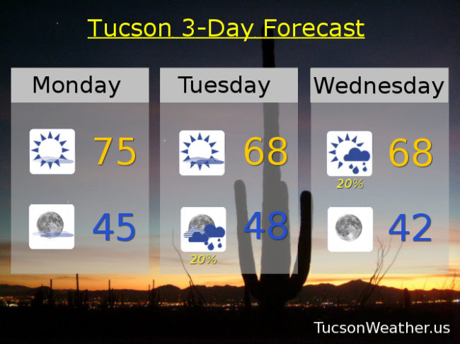
Meanwhile, we hit 78 again yesterday for the third day in a row. Today we start to cool things down. An upper low off the California coast is feeding us a few high clouds from time to time for possible sunrise and sunset enhancement. Otherwise mostly sunny today with a high near 75. A cool front moving through today will continue to knock our temperatures down even as our low approacheth. Increasing clouds tomorrow with a chance for rain showers Tuesday night into Wednesday morning. Nothing to get too excited about. Rainfall amounts are expected to remain below a tenth of an inch in valley locations. The low clears Wednesday taking the clouds with it but leaving the cool (average for this time of year) temperatures in the upper 60s Thursday and Friday. Lows near 40 Friday morning and in the upper 30s Saturday morning (also about average for this time of year). High pressure builds back in for a bit of a warm up for the weekend. Highs in the low 70s Saturday and Sunday. Enjoy!