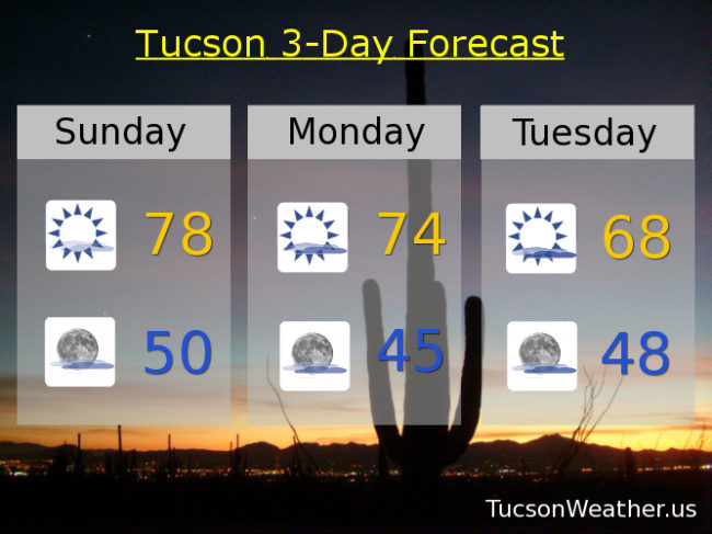
Our southern disturbance in the force has moved east into far west Texas and has taken the clouds with it. That leaves us with a sunny day most of the day, but a few more clouds will be moving in the afternoon as a northern storm approacheth from the Great Basin on its way to the Four Corners. (that was one sentence!) This will also give us a cooling trend tomorrow into Tuesday. The southern jet stream will become more active with another disturbance headed our way Tuesday into Wednesday with more clouds and yes, a slight chance of rain, Tuesday night into early Wednesday! The computer models aren’t in agreement on this, but are trending that direction, so maybe some showers in our somewhat near future. Then again maybe not. We’ll have more information as we get closer. What is more certain is gusty east northeast winds at times Wednesday into Friday. Lows pretty low Friday and Saturday morning in the upper 30s to low 40s. Stay tuned!
Mostly sunny today with a high near 78.
Partly cloudy tonight with a low near 50.
Mostly sunny tomorrow with a high in the mid 70s. Partly sunny Tuesday with a high in the upper 60s. A slight chance for showers Tuesday night into Wednesday morning with a high in the upper 60s. Sunny Thursday upper 60s. Low 70s Friday. Mid 70s Saturday.