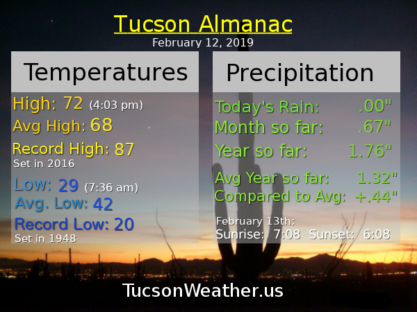
Almanac for Tuesday, February 12, 2019


Cue Neil Sedaka… “Oooooo I hear laughter in the rain. Walking hand and hand with the one I love…” Or. You could just get dinner reservations, I don’t know, INSIDE the restaurant. Yes, Valentines Day is looking rather rainy. Today, however, looks amazing! Warming up after our freezing temperatures this morning (down to 30 so far at the airport). Increasing clouds this afternoon as our warm and wet storm approacheth. Mostly cloudy and even warmer tomorrow with a slight chance for showers tomorrow night. Prime time looks to be Valentines Day and evening with snow levels way up there. Rain in Summerhaven and even Ski Valley. Valley locations could see a quarter to half inch of rain. We’ll see. A break in the action Saturday with a slight chance for rain by Sunday. Early next week is starting to look interesting. It’s early yet, but we could (could) be looking at a rather cold storm with rather low snow levels. Stay tuned!
Mostly sunny today and warmer with increasing clouds by this afternoon and a high in the upper 60s. Mostly cloudy tonight low 40s. Mostly cloudy tomorrow low 70s. 20% tomorrow night and 50% Valentines Day with a high in the upper 60s. 50% Thursday night and 20% Friday high in the upper 60s. Partly sunny Saturday mid 60s. Mostly sunny Sunday low 60s. 10% Sunday night and Washington’s Birthday upper 50s. Enjoy!

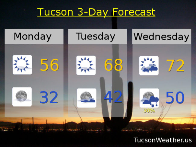
Get your red hot cold fronts here! And it’s on its way… ETA any minute now ushering in colder air today and tonight. (that’s what cold fronts do) A few high clouds today, so maybe (maybe) sunset enhancement tonight. Mostly it will be sunny and cooler. Tonight dropping to near freezing. I haven’t decided if I’m bringing in the plants from the deck for some Netflix… Warming back up tomorrow and Wednesday. Our next storm looks to be wet and warm. Snow levels around 8,500 feet! Maybe a quarter to a half inch of rain Wednesday night, Thursday and Thursday night. A cooler system in here by Sunday? Stay tuned!
Mostly sunny and cool today with a high in the mid 50s. Clear tonight near freezing. Mostly sunny tomorrow upper 60s. Mostly cloudy Wednesday low 70s. 30% Wednesday night and 50% Thursday upper 60s. 30% Thursday night and 10% Friday near 70ish. Mostly sunny Saturday 70. Upper 60s Sunday. Enjoy!

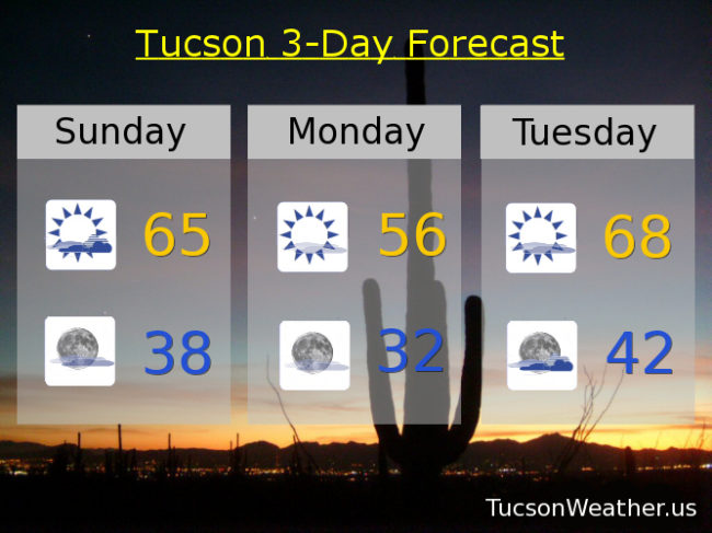
Lots of high clouds yesterday and this morning as a storm is set to move through the Great Basin tonight. Moisture is being pulled northward into Arizona ahead of the storm, hence the clouds. A cold front approacheth and as it moves through tonight we could see some rain to our south and east and also to our north and east. Here we are, stuck in the middle, with maybe a few sprinkles or a spare light rain shower. (brother can you spare a light rain shower?) Cooler tomorrow with more sunshine as the front sweeps away most of the clouds and colder air filters in behind the front. Some warming Tuesday and Wednesday between storms with increasing clouds Wednesday as our next storm approacheth. Lots of moisture with this next storm for a good chance for rain Wednesday night into Thursday night. Snow levels look really high (8,000ish feet) for mostly rain in Summerhaven. It looks like increasing moisture for next weekend for more showers perhaps. Perhaps. Stay tuned!
Partly sunny today with a high in the mid 60s. Mostly clear tonight upper 30s. Sunny tomorrow mid 50s. Near freezing Tuesday morning with a high in the upper 60s. Mostly cloudy Wednesday near 70ish. 40% chance for showers Wednesday night and 50% Thursday. Thursday’s high in the mid 60s. 30% Thursday night and 10% Friday with a high Friday in the upper 60s. 10% Saturday upper 60s. Enjoy!

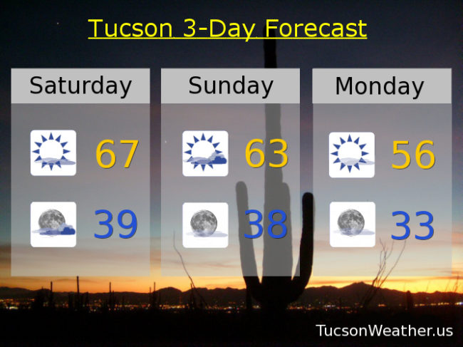
Yesterday was downright balmy compared to the couple dayz before. One more day of the “warm” stuff before another cold front smacks us in the face. (OK, it won’t be quite that dramatic, but kinda) A weakening storm off the California coast is pulling moisture northward into southern Arizona again. Increasing mid and high level clouds today into tonight with a high near the average of 68. Sunrise and sunset enhancement possibilities too. The storm will miss us to the north but drag a cold front through early Monday morning for a “nice” cool down. Maybe some showers as far south as the Metro, but more likely to our north. We warm back up again Tuesday and Wednesday before our next storm. Wednesday night and Thursday could be a rainy time of it with early indications indicating (that’s what indications do, you know) perhaps an inch of rain with this storm. It’s early yet. Predicting the future is hard. We’ll all just have to stay tuned!
Increasing clouds today with a high in the upper 60s. Mostly cloudy tonight upper 30s. Partly sunny tomorrow low 60s. Mostly sunny Monday mid 50s. Mid 60s Tuesday. Partly sunny Wednesday low 70s. 30% chance for rain Wednesday night and 40% Thursday. Thursday’s high in the mid 60s. Partly sunny Friday upper 60s. Enjoy!

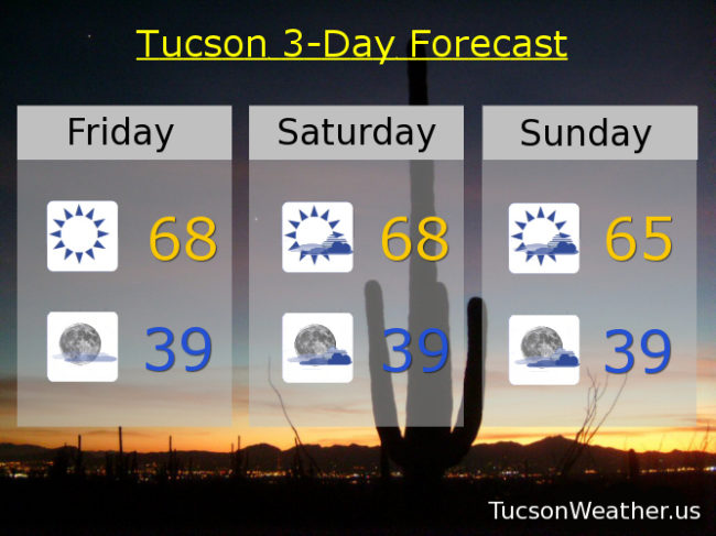
It’s Friiidaaay!!!
This morning’s low dipped to 32 officially at the airport. It’s freezing! Well, we’ve “climbed” to 33 at the time of this writing (6:40 a.m.), so there’s that. Warmer today with sunshine, but we’ll see an increase in clouds just in time for the weekend. A system missing us well to the north is the culprit. Staying dry for now. Our next rain and high mountain snow possibilities arrive around mid next week. Until then it’s a mix of clouds and sun for possible sunrise and sunset enhancement and temperatures running a few degrees below, to near, average for this time of year. Stay tuned!
Sunny today with a high in the upper 60s. Mostly clear tonight upper 30s. Partly sunny tomorrow upper 60s. Mid 60s Sunday. Mostly sunny low 60s Monday. Mid 60s Tuesday. Partly sunny low 70s Wednesday. 10% chance for showers Wednesday night and a 30% Thursday. Thursday’s high in the upper 60s.