Monthly Archives: July 2018

Forecast for Wednesday, July 11, 2018

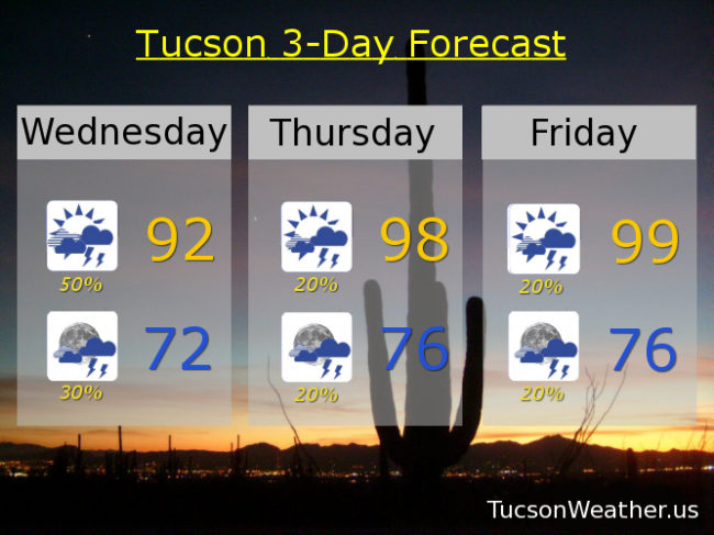
Here we go again! Very active day yesterday in Marana and Oro Valley with some areas getting 2 to 2 1/2 inches of rain! Who knew that we would put the rain in train with the storm causing a train derailment in Marana. Yikes! A few water rescues too, but the good news is no one got hurt. Please continue to enjoy Monsoon 2018 responsibly as we are looking at another round of storms, some with heavy rain today. Already breaks in the clouds this morning and if we see sunshine that will help storms to get going starting this afternoon. Additionally we have a disturbance in the force riding northward into the area from Mexico this afternoon to help the cause. Very rich moisture in place, so we will likely see heavy rain again today in some areas and maybe we’ll send another haboob to Phoenix. Today’s high in the low 90s should occur in the early afternoon before the rains get going.

Scattered showers this evening ending before midnight with a low in the low 70s.

Rain mainly on the wane Thursday and Friday but still a few storms about with highs in the upper 90s.

Storm chances ramp back up this weekend with a low headed our way. 40% chance Saturday upper 90s. 30% Sunday low 90s. 30% Monday mid 90s. 30% Tuesday upper 90s. Viva Monsoon 2018!
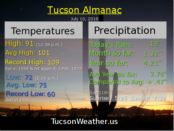
Forecast for Tuesday, July 10, 2018

Interesting day yesterday. Most not getting the advertised rain with some notable exceptions. An early afternoon storm dumped some nice rain on the Tortolita Mountains which moved to the east and got parts of Marana. Then three separate showers with some thunder formed over southern Oro Valley. Downtown Tucson had a quick downpour later in the afternoon. Then there was the airport. 1.01″ inches of rain fell! A new record for the date. Most of it came down in about a half hour!

If you missed out on yesterday’s showers I give you hope. Light rain (half the calories of our regular rain) moving through the Metro this morning should end in an hour or two. Then mostly cloudy skies most of today. If we get some clearing that will certainly help the cause for afternoon and evening storm chances. Still. The inverted trough we’ve been talking about is now to our west, but still close enough to add some instability to the atmosphere. The National Weather Service has our afternoon storm chances at 50%. Lots of moisture in place so some of the storms may produce locally heavy rainfall. Hopefully near you! Today’s high only in the low 90s.

Scattered showers and storms possible tonight, perhaps a few overnight, with a low in the mid 70s.

40% chance for storms tomorrow afternoon/evening with a high in the upper 90s. 30% chance for storms Thursday upper 90s. 20% chance Friday upper 90s. 40% chance Saturday mid 90s. 30% Sunday mid 90s. 30% Monday upper 90s. Viva Monsoon 2018!

Forecast for Monday, July 9, 2018

Well that was fun! The Foothills, Oro Valley and Marana the big winners with last night’s storms. It’s fixin’ to get even funner for those who missed out last night. Just a trace at the airport yesterday, but the OV received a half inch to three-quarters. Lots of lightning too!

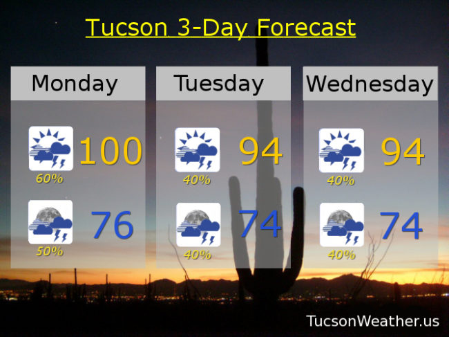
Lots of moisture with us and a low pressure trough approacheth. That should act as a trigger for rounds of storms starting as early as 11:00 this morning. Thunderstorms likely today, hopefully a few near you, with a high near 100.

Off and on storms are likely to continue through the overnight hours with a low in the mid 70s.

Low pressure trough still with us for a 40% chance for storms Tuesday and Tuesday night. High in the mid 90s.

A possible disturbance in the force riding northward out of Mexico Wednesday should provide a focus for more storms to form Wednesday and Wednesday night. High in the mid 90s.

“Things” calming down a bit Thursday but still a 20% to 30% chance for storms afternoon and evening mid 90s. 20% chance Friday upper 90s. Just a 10% chance Saturday mid 90s. 20% Sunday mid 90s. We do need the rain! Viva Monsoon 2018!!!

Forecast for Sunday, July 8, 2018

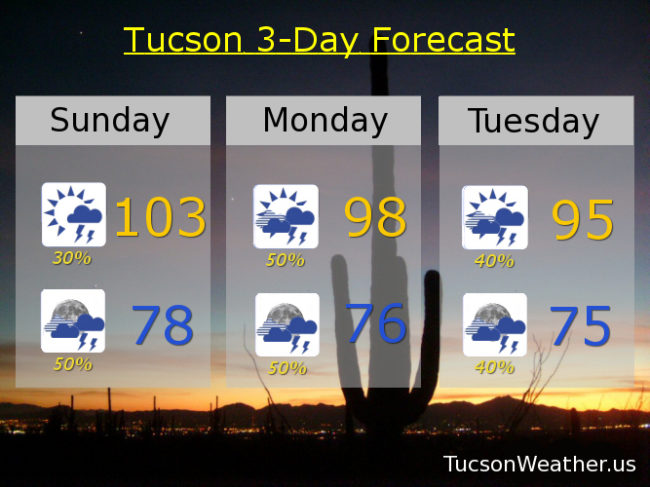
Viva Monsoon 2018! We managed 107 yesterday afternoon before a few storms moved in from the NE as advertised. Only a trace officially at the airport, but some of you had a nice shower or two. We do it again today except we have more moisture in place which should help things get started a little earlier. Also, it won’t be as hot. Today’s high near 103 which should be the last day over a hundred for awhile. As storms move in this afternoon/evening from the NE we could see areas of blowing dust, so the National Weather Service has issued a BLOWING DUST ADVISORY from 2:00 this afternoon until 8:00 tonight. Be advised, there may be blowing dust especially in the blowing dust prone areas such as near Picacho Peak and Casa Grande along I-10.

Storm chances increase tonight as we enter an active Monsoon 2018 pattern for the first half of this week! High pressure shifting a little bit north which will open the door for an inverted trough to move through Monday into Wednesday. The extra lift provided by the trough means we won’t have to depend on afternoon heating to get storms going (although that won’t hurt). And that means we could get storms morning, afternoon and night through Wednesday! 50% chance for storms tonight upper 70s. 50% chance for storms tomorrow and tomorrow night upper 90s. 40% chance for storms Tuesday, Tuesday night, Wednesday and Wednesday night mid 90s.

The trough leaves us, but the moisture stays Thursday into the weekend. 20% chance for storms Thursday mid 90s. 20% chance for storms Friday mid 90s. 10% chance for storms Saturday upper 90s. Did I mention? Viva Monsoon 2018!

Forecast for Saturday, July 7, 2018

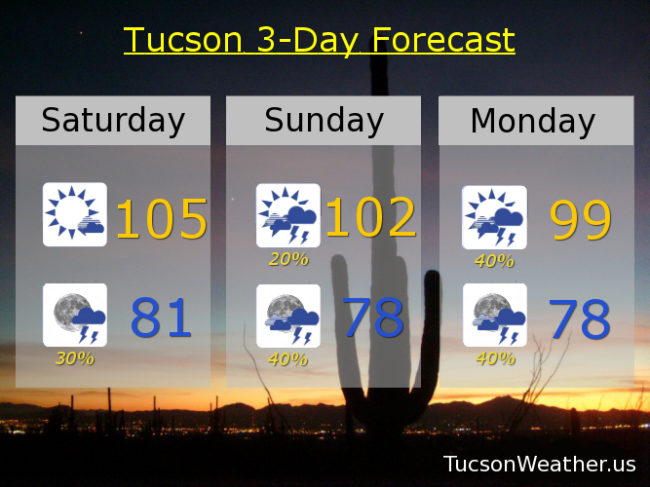
Here we go! Monsoon 2018 is fixin’ to show up for reals starting as early as tonight. Moisture back on the increase with disturbances in the force along with an inverted trough is gonna light up our skies. Mostly sunny today with a high near 105. Storms forming to our NE should work their way our way by tonight for a 30% chance for scattered storms and a low in the low 80s.

A 20% chance for storms on Sunday with a high near 102. Then. Here comes an inverted trough. An area of low pressure moving from east to west along the bottom of high pressure centered to our NNE will add extra lift to the atmosphere and help storms to get going Sunday night and Monday. Monday’s high near 99.

Then it’s general Monsoon activity the rest of the week with random disturbances to help out. Yay! 40% chance for storms Tuesday, Wednesday and Thursday mid 90s. 40% chance for storms Friday upper 90s. Viva Monsoon 2018!