
Monthly Archives: June 2018
Forecast for Monday, June 4, 2018
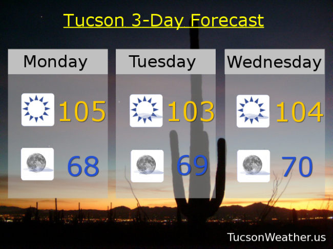
105 yesterday avoiding the record of 107. Today’s record of 112 is safe, thankfully! Still on the hot side of things because, June. 105 again today if the forecast becomes exactly true. The Cicadas have been broadcasting Monsoon the last week or two and it looks like the weather pattern is slowly shifting that direction. Of course early Summer storms around these parts are more winds and dry lightning than rain and that’s what we may see in the mountains east of us as our high pressure moves into Texas by mid week. Still dry and on the hot side here in the metro in the foreseeable future. However… By this weekend a SE to easterly flow will bring more moisture to SE Arizona. Again, the big winners will likely be to our east, but we have to start somewhere. One hot day at a time, but Monsoon 2018 is lurking!
Sunny today with a high near 105.
Mostly clear tonight with a low in the upper 60s.
103ish tomorrow. 104 Wednesday. 106 Thursday. 108 Friday. 106 Saturday. 105 Sunday.
Almanac for Sunday, June 3, 2018

Forecast for Sunday, June 3, 2018
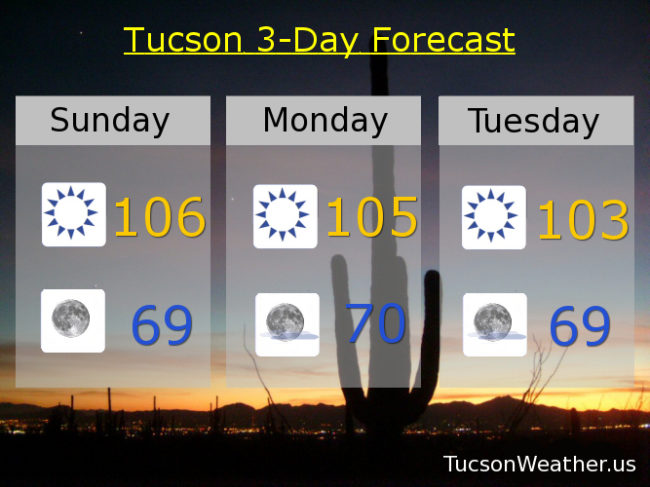
Just gorgeous on the deck this morning! Looks like 66 will be our low this morning. So nice! However, dry air warms quickly and high pressure is large and in charge. The National Weather service is now saying our high today will be 106. If it comes exactly true we’ll avoid tying the record of 107 which is just fine with me. High pressure still expected to move into the Texas Panhandle by mid to late next week which will open the door for moisture to move north into southern Arizona! Still only expecting a few storms in the mountains east of Tucson, but at least one computer model shows some low level moisture making it into Cochise county late next week. Bears watching, but Tucson should remain dry. Stay tuned and be cool!
Sunny today with a high near 106 and a west breeze.
Clear skies tonight with a low in the upper 60s.
Sunny tomorrow 105ish. 103 Tuesday. 104 Wednesday. 106 Thursday. 108 Friday. 107 Saturday.
Almanac for Saturday, June 2, 2018
Forecast for Saturday, June 2, 2018
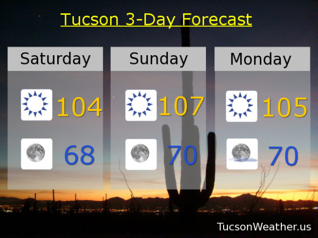
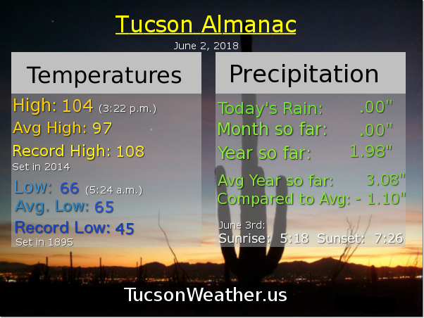
Hot and getting hotter! Must be June. Yesterday we just missed the century mark with a high of 99. With high pressure building in it will be noticeably hotter the next few days. Today’s expected high of 104 is well short of the record of 108, so that will stay safe. However, tomorrow’s expected high of 107 is right at the record set in 1996 and hit again in 2014 and 2016, so there’s that. Please stay hydrated lest you burst into flames! A weak low moving from Baja California into the NW part of the state will give us some breezes through the weekend too, so kinda like a hot blow dryer. “Things” get a bit interesting mid to late next week as the high pressure moves north and east. That will put us in a southerly flow with an increase of mid and high level moisture. However, the low level moisture won’t quite make it out of Mexico. Expect a chance for a few storms over the mountains east of Tucson with fire causing lightning a real threat. Heating up again by the end of next week. June has arrived! Be cool and stay safe.
Sunny and kinda hot today with a high near 104 and a SW breeze 5-15 mph and gusty.
Clear tonight with wonderful coffee on the deck temperatures tomorrow morning in the upper 60s.
Sunny and a bit breezy tomorrow with a record tying high of 107 if it comes exactly true.
105ish Monday. 103 Tuesday. 104 Wednesday. 106 Thursday. 108 Friday.
Almanac for Friday, June 1, 2018

Forecast for Friday, June 1, 2018
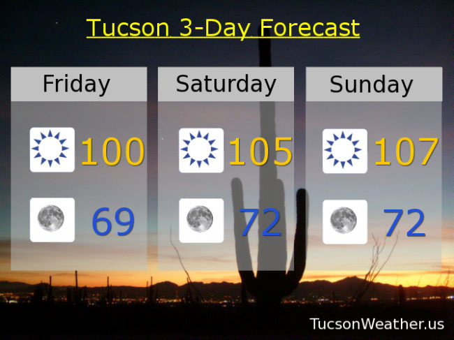
It’s Friiidaaay!!!
It’s also June 1st. You know what that means. Here comes the heat. 100 yesterday and we’ll be right there again today with a bit of a westerly breeze this afternoon.
Very nice morning’s for coffee on the deck. Clear skies tonight with a low tomorrow morning in the upper 60s.
High pressure building in for the first 105+ days of the season, again, just in time for June. 105 Saturday and a record tying 107 Sunday (assuming it comes exactly true). Some breezes this weekend too, but nothing too crazy. 105ish Monday. 103 Tuesday.
Our high moves northward out of Mexico into New Mexico/Texas opening the door for an increase of moisture! Will we get storms in the metro area? Still up in the air (see what I did there). The better chances will be south and east of us, but as always we’ll keep you posted. Wednesday’s high near 103. 104 Thursday. Be cool!
Almanac for Thursday, May 31, 2018
