Monthly Archives: June 2018
Forecast for Saturday, June 9, 2018

107 kinda sneaked up on us yesterday! There were a few showers and storms to our south and east again as Monsoon 2018 is ramping up! Enough moisture nearby for a repeat performance mainly in Cochise county once again today. Deep rich moisture is lurking in central and northern Mexico and it looks like we will be getting in on that next week! Drying out some tomorrow and Sunday as a system misses us well to the north, but the resulting westerly flow will keep the moisture at bay temporarily. A lot to get excited about next week as confidence is growing for a surge of moisture into southern Arizona! A slight chance for storms as early as Tuesday evening in the metro and those chances increase especially Friday and Saturday. Just in time for the official start of Monsoon 2018. We may not have to wait until the 4th of July like most years. Looks like we are gonna get the party started early! We need it. Stay tuned!
Sunny and hot today with a high near 105.
Mostly clear tonight with a low in the low 70s.
Mostly sunny tomorrow, Monday and Tuesday with highs near 104ish. Slight chance for isolated storms Wednesday 104. Better chance for widely scattered storms Thursday 100. Scattered storms Friday mid 90s!
Almanac for Friday, June 8, 2018

Forecast for Friday, June 8, 2018

It’s Friiidaaay!!!
A little drier this weekend, but still enough moisture for a few showers and storms east of us in Cochise County. Still kinda hot here today with a high of 105 for the third day in a row if it comes exactly true. Drying out a bit more temporarily early next week, but the second half of the week looks pretty interesting. High pressure reestablishes itself to our east opening the door for a southerly flow to bring the deeper moisture that is just to our south into southern Arizona. There is a chance for showers and storms as early as Wednesday, Metro included! I got my new windshield wipers yesterday just in time. Hurricane Aletta off the Mexican coast is too far south and west to affect us directly, but has added to the moisture to our south in Mexico. Another possible tropical system, Bud, next week could help the cause even more. Monsoon 2018 starts a week from today officially. Looks like we may be off to an earlier than 4th of July start this year. Let’s hope so. We need it! Stay tuned.
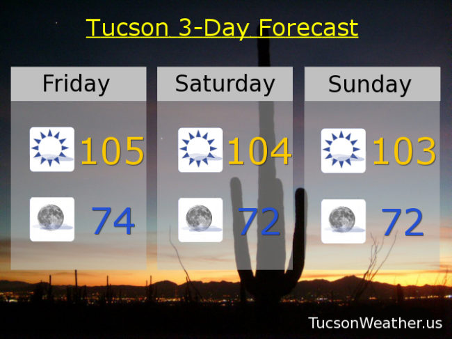
Sunny today with a high near 105.
Partly cloudy tonight with a low in the mid 70s.
Mostly sunny tomorrow 104ish. 103 Sunday. Near 100 Monday. 103 Tuesday. Slight chance for storms Wednesday. Slightly better chance for storms Thursday.
Almanac for Thursday, June 7, 2018

Forecast for Thursday, June 7, 2018

Monsoon 2018 seems to be clearing it’s throat . A severe thunderstorm near Douglas yesterday dropped dime size hail and a decent amount of rain. Other storms were along and south of I-10 east of Wilcox. Thunderstorm chances return again today east of the metro although a couple of models are suggesting we could see some development as far east as the Rincon Mountains! That will be cool if it happens. Otherwise Tucson stays dry as moisture continues to lurk to our south and east. We dry out area wide Sunday as a system misses us well to our north as the resulting westerly flow should kick the moisture to the curb. Next week looks really interesting as models are showing a more SE flow which should give us more widespread moisture in southern Arizona. The National Weather Service even has a slight chance for storms in Tucson by Wednesday. Stay tuned!
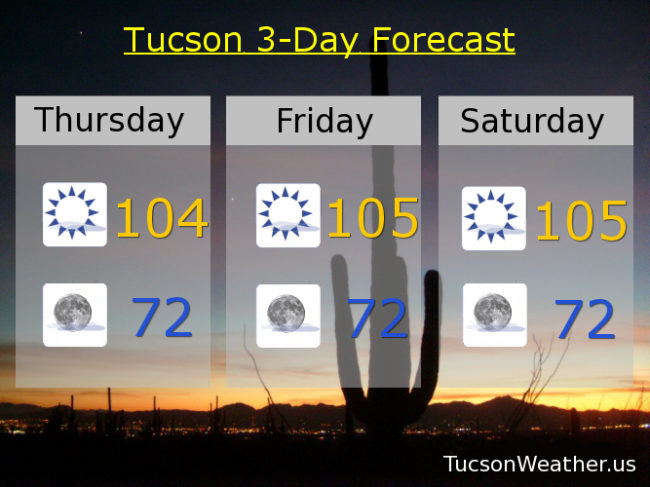
Mostly sunny today with a high near 105.
Mostly clear tonight with a low in the low 70s.
Near 105ish tomorrow and Saturday. 103 Sunday. 101 Monday and Tuesday. Slight chance for storms Wednesday 103.
Almanac for Wednesday, June 6, 2018

Forecast for Wednesday, June 6, 2018

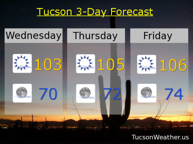
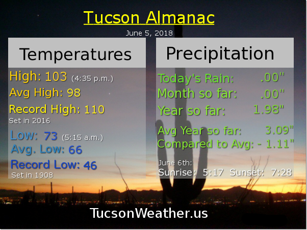
Well that was unexpected! A moisture surge yesterday into the Metro pushed dewpoints to 50 degrees! Enough for a few storms to form in Cochise County even. One rain gauge in the Chiricahua Mountains picked up a whopping .07″! Still. It’s beginning. Dewpoints this morning are in the upper 30s to near 40 keeping us from cooling off as much as we would have with drier air, but mid 70s this morning is still nice for coffee on the deck. A westerly to SWesterly flow should dry us out some so no real threat for storms in Tucson just yet. Heating up a little bit the next couple of days. 103 yesterday and today. 105ish tomorrow. 106 Friday and 105 Saturday. Still keeping an eye on tropical development off the west coast of southern Mexico. That moisture is expected to move towards Cabo and maybe we can manage to get in on some of that next week. Bears watching and we will. A bit cooler next week too with 103 Sunday. 101 Monday and Tuesday. Stay tuned!
Almanac for Tuesday, June 5, 2018

Forecast for Tuesday, June 5, 2018

High pressure to our SE still trying to get moisture to cross into SE Arizona. The bad news is that the high will not quite be in position to give us storms along the international border unless a storm close enough in Mexico pushes an outflow boundary far enough north. The good news is Thursday and Friday won’t be quite as hot as we’ve been talking about the past few days! Still pretty hot though. Another interesting possibility for moisture is off the coast of Mexico. Tropical development there may move far enough to the north to get us some moisture next week. Time will tell. The Cicadas are singing! Monsoon 2018 will arrive when it arrives. We’ll keep you posted as we go.
Sunny today with a high near 104.
Mostly clear tonight with a low in the low 70s.
Sunny tomorrow 104ish. 105 Thursday. 106 Friday. 105 Saturday. 103 Sunday. 102 Monday.